
Google photos has added a great new feature that allows the search of stored photos based on where these photos were taken. It takes a while to roll out this feature to all Photos users so you may not have access at this time.
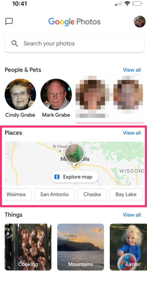
Photos allows a search of your photos by location (assuming you have the GPS location to be saved as part of the EXIF data). Storing GPS locations can usually be allowed when taking photos with a phone. To find photos by location a Photos user should click on the search icon which offers multiple ways to search your collection. The map feature is enclosed in the red square in the following image.
Heat map
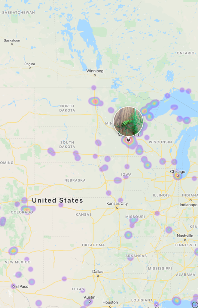
Selecting “explore map” offers a map of the world with the areas associated with photos you have taken heat mapped. For the following demo, I have manipulated the map to center on southern Africa.
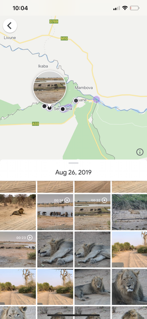
I can use the composite display in multiple ways. I can select a dot to reveal the photos taken at the location or I can select a photo to find the location. Many of the photos here were not taken with my phone. However, Google photos are also organized by date so that if I have taken any photos with my phone on a given day, the photos taken with the phone will be linked to the map and the other photos taken on the same day will be available in the collection for that day.
![]()
You must be logged in to post a comment.