
I understand the interest in drones. I have a brother who has purchased several drones as a hobby, but despite my interest I just don’t anticipate I would find many uses should I make the investment.
I encountered another example of the use of a drone yesterday and I am trying to figure out just how the application works. We committed to putting solar panels on our home early this year. We are now waiting to see if we are selected for the subsidy in 2022. A representative from the company that will do the work visited our home yesterday to investigate how the connection to the electrical grid would work and to determine exactly where on our roof the panels would be placed. We had a new roof put on this past year because the shingles had some hail damage and you have to remove anything on your roof when adding satellite dishes, solar panes, etc. You don’t want to pay for the installations several times. Evidently, the company that will do the work has decided to use a different panel from the original plan and new measurements were necessary to determine how many of the panels (the new ones are smaller) could be added. To collect the measurements, the technician used a drone.
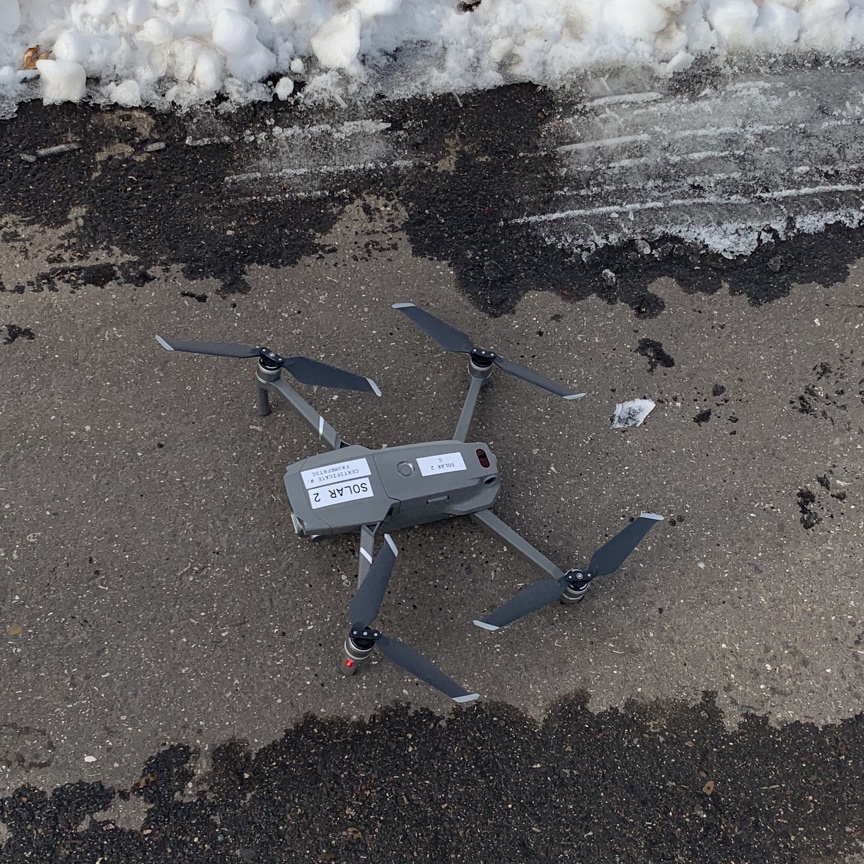
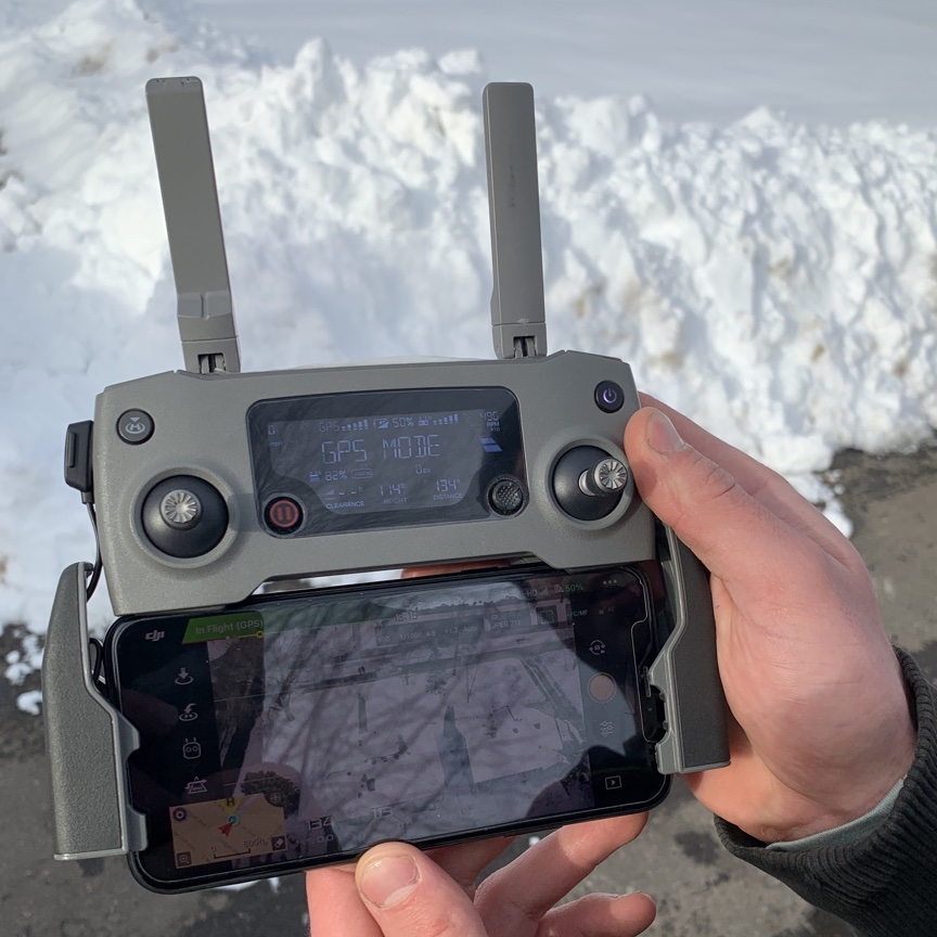
I have found that people like to talk about their work so the technician was pleased to let me take photographs and talk about his work. If you look closely at the screen on his controller, you can kind of make out two houses with the view of our roof appearing on the right. The technician said that he just had to outline our roof and the drone would then fly in a circular pattern so that multiple images could be taken. The images would be run through some type of analysis program to determine the dimensions of the roof and how much space was available on the part of the roof that was most efficient for collecting energy from the sun. I was trying to imagine just how a program would be able to accurately determine the area of parts of the roof. I would think it would require more information stored with the images. Wouldn’t it be necessary to at least know the height from which images were taken to calculate area from the size of the images that were captured? Pretty cool technology.
For anyone interested in this technology, the technology that does the calculations is called Scanifly.
![]()
You must be logged in to post a comment.