I am working on a personal project to prepare for a long trip I hope to take driving the ALCAN highway this summer. We received our second COVID vaccine today and I am optimistic things will open up some by July. We drove this route many years ago when some of it was still gravel and we want to make the trip one more time in our retirement. Among other goals, I want to generate a map of the route complete with photographs and annotations.
It used to be that one of the most popular ways to do this was to use Google Map Maker. However, Google has abandoned Map Maker. By the way, if you are interested in this topic beware when you read tutorials online. Check the dates of posts or you might assume should guide your exploration and pay attention only to recent content. There are plenty of Google-related suggestions that simply do not work anymore.
I have decided to spend time with Google My Maps. I have been able to get it to do what I want (create a Google map showing the location of photos and export the KML file so I can show photos in Google Earth). I have generated a proof of concept, but the method is very tedious and I will wait before I offer a description on this blog. If anyone reading this has suggestions related to this general goal, please add a comment to this post (I am aware of Scribble maps, but the cost per month seems very high).
Anyway, I have decided to explore my ultimate goal by making use of my photo collection from Southern Africa. I have several hundred photos taken with a combination of my iPhone and my SONY 6300. The iPhone saves geolocation data and the plan was to use these data to determine precise locations and to upload images taken with the SONY using the location taken from iPhone photos for SONY photos from similar time and date. It should work. I cannot figure out to do this in some type of “batch” approach so what I have worked out to this point won’t be for everyone.
Projects like this help me develop some sympathy for less experienced users trying to figure out things on their own even when they carefully follow instructions they find online. Here is an example. I can still find many photos from the African trip on my phone even though the trip was in 2019 and I have some unique photos on the phone I did not upload to Google Photos or Flickr. I prefer doing projects like this on a Mac, Chromebook, or my iPad because of the larger size and keyboard, but I have discovered the different devices don’t work the same even when using the same apps. This is what I mean by getting frustrated – you follow the directions for a given technique on a different device and you may not be successful.
Here is an example of what I mean. Here is a screenshot from my iPhone. It shows a coffee maker (you were expecting elephants) in a lodge and if you scroll down, the iPhone shows the position of the photo on a map.
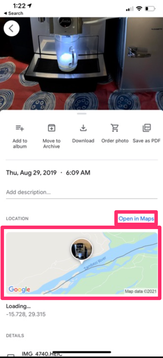
I played around a lot with the options from these displays. If you use the “Open in Maps” link (smaller red box), you get the following display.
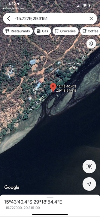
This is what you see – the position of the photo on a map. For future reference, the useful thing about this display is that you can copy the coordinates and paste into My Maps to add a location for a photo as part of a personal layer. This is part of the way I eventually added images to this layer.
However, if you click on the map itself and not the link, you get a very different display allowing some different and useful data.
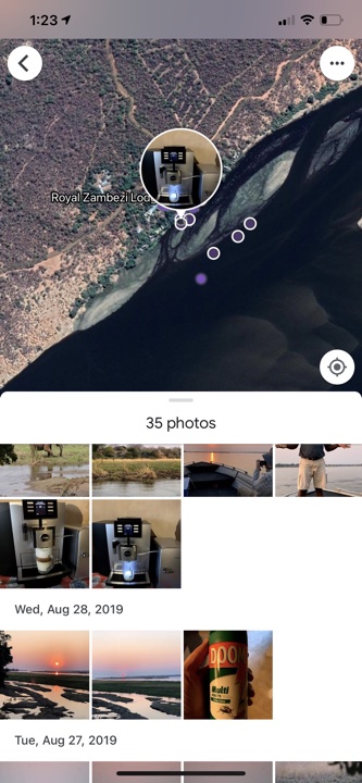
This display shows the position of other photos I took near the photo I had selected. You can see some of these other photos displayed with dates and you can access them by clicking on the small circles in the display. You can also move the map around to show areas not presently visible and photos taken in those regions as well. So, the coffee maker was located in the Royal Zambezi Lodge and this information would allow me to search my Google Photos by date to add other images to map at approximately the same location.
You could try this same approach on an Apple desktop machine or an iPad and you would not have access to this second type of display. There isn’t a separation between the link and map as found on the iPhone and selecting the map shows the location of one photo only.
![]()
You must be logged in to post a comment.